Is it possible to get the RSP Portal to display a tract/patch overlay grid when viewing a HiPS map? I gather I could generate and upload some DS9 region files to do this, but I think the ideal UI would have the patch grid only appear below a certain zoom level, and I figure it’s entirely possible I’m just not looking in the right menus.
A partial answer to my own question (though I’m still curious if there’s something better):
- Select a region in the HiPS map.
- Use the search region tool on the far right of the new toolbar that pops up to do an ObsCore search for deep coadds.
- Look at the coverage tab (it took me a while to realize that the patch grid appeared here, but not in the original HiPS tab). It shows the patches, and if you know what you’re looking for you can see where the tracts are from the offset-in-RA rows.
I’m not sure if that just works for ObsCore or anything with a region column.
There isn’t an elegant solution for this that “just works” right now, the way that I would like.
The way that I tend to do this is to search on the dp2.CoaddPatches table. If you do that, you can get to a display like this (note that I’ve used a table filter to limit the result to a single tract):
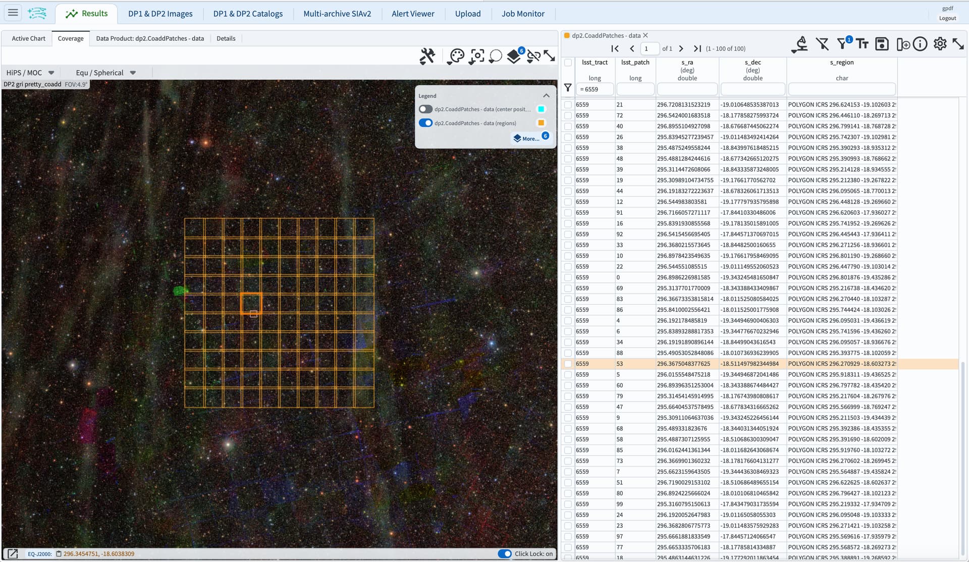
I would like to add a way soon to get just the tract boundaries. Thanks for the prompt - I think I have a simple notion for how to do that now.
But the longer-term desire is to have a zoom-sensitive scheme that shows tracts when zoomed out, patches when zoomed in, shows tract and patch ID overlays on the image, and optionally shows the fiducial regions of the tracts and patches.